personnel efficiency
time consumed for production operations


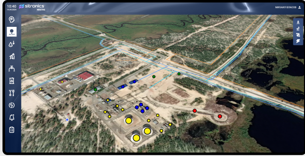
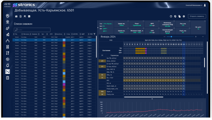
Up-to-date asset state 24/7

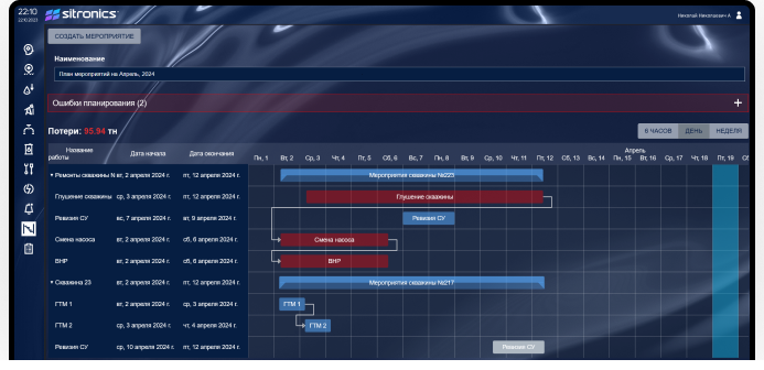
Execution of action plans
Production data and well flow rates in a user-friendly interface

Monitoring and management of operational risks based on historical data and predictive analysis.
The system collects field data from MES/ERP systems and performs validation in automatic mode
All data is fed into a dynamic object model and time series for analysis and display in a digital field system
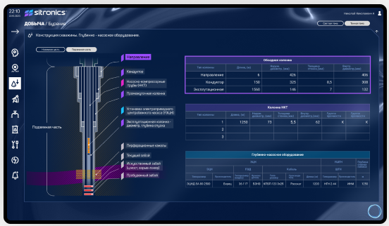
Data is analysed using customisable graphs, dashboards and mnemonic diagrams
Calculates parameters, monitors well operating conditions and calculates production back distribution
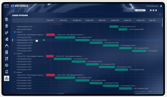
Calculates production schedule and field development parameters
Generates an integrated plan and its optimisation ML-model based on big data
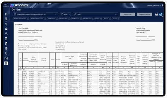
Prepares materials for to support decision-making - plans, reports, schedules, alerts and forecasts
Всесторонний анализ текущей ситуации на объекте разработки, достигаемый за счет интеграции регулярно обновляемых данных из различных источников
Успешное планирование запуска новых скважин и проведения геолого-технических мероприятий, снижение рисков получить ограничения по системе сбора и подготовки
Качественное управление фондом и системой сбора за счет оперативного факторного анализа отклонений заданных параметров систем
Эффективное планирование объемов добычи с учетом промысловых работ и параметров системы разработки, а также возможность быстрого кросс-функционального анализа проблемных и перспективных участков за счет универсального доступа к данным и визуализации в одном окне


Logistics platform segments
POSSIBILITIES
Control
and optimization
IT and integration
Situation center
Control
Service
Weather risk management
Job Analysis
Integration with external information systems
Port systems
Counterparty systems
Warehouse systems
Monitoring systems: AIS, GPS and others
Monitoring systems: AIS, GPS and others
Hydrometeorological and ice monitoring and forecast services
External ERP systems,
including those based on SAP